

On May 23rd, 2026, I began a 135-mile trek from my apartment in Seattle, WA to Vancouver, BC. Along the way, I recorded a number of audio logs, which have been transcribed, edited for clarity, and substantially adapted for readability, along with photos and maps for context. You are welcome to listen to the original recordings, read the transcripts as a normal blog post, or both. You may want to turn your volume down—the recordings are unedited, and I am often talking into my phone microphone with substantial background noise from cars.
This post is the first of three posts.
day 0: context
Hello! It is 4:20 PM, Friday, May 22nd, 2026—I just put in my laundry in preparation for tomorrow’s walk. I’m recording this partially as to see if this system will work, and partially because I really don’t want to provide all this context while I’m walking. If this works, maybe you’re seeing this on Substack;1 if it doesn’t work, then the only people hearing this are the people who read my private journal. I’m trying out audio recordings partially because I don’t want to bring my laptop on the walk, but I also don’t want to post my daily journal2 from my phone, because that sounds awful.
So, the walk.
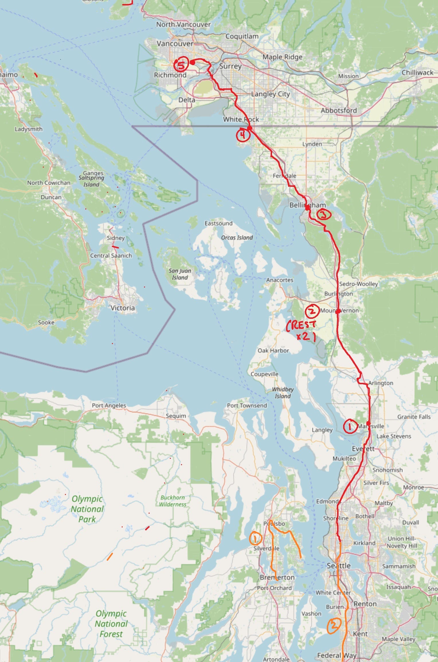
I currently live in Seattle, near Green Lake and 65th Street. The goal is to walk to Vancouver, British Columbia.3 This will take five days of walking:
The first day is to Marysville, just northeast of Everett, just outside of what would traditionally be considered the Seattle metro area. This will take about 30 miles.
The next day will be another 30ish miles, out to Mount Vernon.
After that, the idea is that we will take two days off, just sitting and vegetating in a hotel room, hoping to rest up again.The third day of walking is about 25 miles, to Bellingham. I’m going to be joined by one of my friends in Bellingham, who will help supply me with things that I need and be there as a person that I can call if things go wrong.
The fourth day is 25 miles, to Blaine.
The fifth day is the walk from Blaine across the Canadian border, and hopefully all the way to Vancouver.
We’ll see how it goes.4
I’ve done a couple of walks like this before. There’s no good explanation for why5—I first got into walking during the pandemic, in Spring 2021, when there was nothing to do and I was stuck on MIT campus. That semester, I did a 26-mile trip, following the Boston Marathon route all the way from Hopkinton, MA into Boston.
After that, I’ve mostly done random long walks.6 The longest walk I’ve ever done was in Fall 2023, right before I started my MEng, when I took a very long walk with a couple of friends. This walk covered 63 miles from Kittery, ME all the way back to Cambridge, MA, and took 22.5 hours. We did that walk mostly so we could say that we’d walked from Maine to campus; similarly, I am doing this walk mostly so I can say that I’ve walked to Vancouver.
I’m a little anxious about the walk. I didn’t train quite as much as I would have liked; my only big training walk was last weekend, which is a little too late for a training walk—one should be tapering at that point. I walked 54 miles last Saturday and Sunday: on Saturday, I walked from Bremerton to Bainbridge, which are two islands in the Puget Sound; on Sunday, I walked from my home to Federal Way, in the opposite direction of Vancouver.
The training walks were… doable. Theoretically, the most dangerous part of this walk is the first sixty miles from here to Mount Vernon, because I’m doing those alone and on consecutive days. This is also the part of the walk that’s most analogous to last weekend, which I survived, but it resulted in some pain in my left Achilles and my right knee. That pain has mostly gone away, but I have still some mild anxieties about it, since it was very present at the beginning of the week. I’m anxious to get to bed early today so I can start early tomorrow, and so that I can hopefully have most of that damage healed.
I’m not committed to making it fully to Vancouver. It’s very possible that if I commit too hard, I will substantially injure myself, and that’s something I am worried about.
But, that’s the plan.
As for the rest of today: the laundry will continue. We’ll pack a light bag, probably just a drawstring, with a couple of changes of clothes, and my nice camera with just one lens.7 A battery pack, a FitBit charger, and a water bottle. Everything one needs to walk a long way.
I’m planning to record these messages at appropriate times in the walk; i.e., the beginning of each day, the end of each day, and whenever I feel bothered to do so during the day, especially if I need to take a little break. Hope to see you around! If no one ever sees or hears this—
Well, I am anxious. I am quite nervous about this. This seems like the kind of thing that I could really, really injure myself doing, because God knows I don’t have a sense of self-preservation when it comes to pain and completing a task.
—we’ll see how it goes. Maybe I’ll cut that last part. I don’t know. I don’t want to spend time editing this…
Okay, okay, that’s the context. Good luck. To me. In the future.
It is now 10:25 PM.8
I ate dinner, showered, and packed my bag—I’m basically as ready as I’ll ever be to start this trip. I’m a little anxious about day one, because it’s pretty determinative for the rest of the trip—if it goes well, I’ll know whether or not I can do day two; if it goes poorly, it goes poorly.
A little preview of the route. I’m going from Seattle proper, around 65th Street, all the way up to Marysville. This area is mostly populated; it goes through a bunch of suburbs, like Mountlake Terrace9 or Shoreline, then Lynwood, then Everett, then Marysville. One fun thing here is that everything is on a grid, so I’m going from N 65th St up to the top of the King County grid, around N 205th St. Then, the numbering resets and it goes from around S 240th St and counts down all the way to zero. So, I’m going to cover something like 380 streets tomorrow.10
The fact that the area is populated has some upsides and downsides. This is the day with the most elevation change in the walk, which is a little concerning: it’s +1200ft, -1000ft, according to Google Maps. I’m also not a huge fan of the start-stopping of having to wait for pedestrian crossings—sidewalks are great, because you won’t get hit by a car, but walking down the side of the road is nice because you don’t ever have to stop.
That’s the foreword. The weather looks pretty decent: a little warm, but not too much; nothing above 70, so that should be good. I’ll probably do a little recording at the start of tomorrow. We’ll see how it goes.
day 1: to marysville, wa (30.8mi)
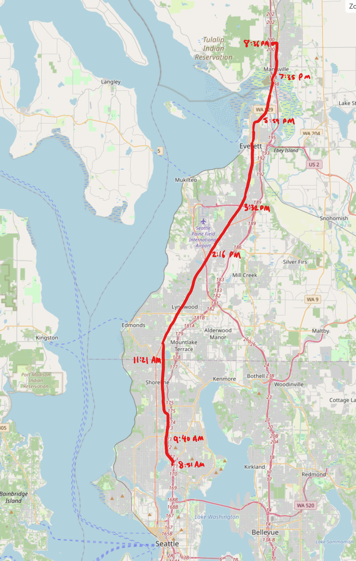
It is Saturday, May 23rd, 8:51 AM. I am still in my apartment, just about to head out. We are at zero miles of 30.8 miles walked, which Google Maps says will take 11.5 hours. We’re going to hope it takes slightly less than that, though not by too much, because if I walk too fast on day 1, I’m going to ruin myself for day 2.
Everything’s ready to go, so—we’ll see you on the other side.
[the sound of a door closing]
It is 9:40 AM.
One frustrating thing about the Google Maps app on the phone is that it only gives two significant figures for distance, but I’ve walked about three out of the 31 miles so far. I’m passing 112th Street; based on some math I did yesterday after the recording, this should be about 10% of the streets, i.e., I’ve walked 47 of what will be 470 streets.11 I’m trying not to look too insane, since, well—imagine you’re walking down the road, and you see someone talking into their phone, and you have absolutely no idea what they’re doing. But, well, y’know, sometimes, that’s the price you pay for making something.
I’ve been trying to use this first portion of the walk where I still have brain cells to think about some things, because, very soon, it will become “no thoughts, head empty.” The thing I’ve been thinking about is modes of work—one personality trait I’m really proud of and care about a lot is my “stick-to-it-ness,” which could be positively be framed as ‘fortitude’ and negatively be framed as ‘stubbornness’. I think trips like this exemplify that characteristic—I’m going to be a tortoise and survive the 31 miles up to Marysville, and then the 140-some miles up to Vancouver, whereas the hare is going to burn itself out and then go to sleep—and it’s generally something I’m very proud of. Sure, you have to survive because you have to survive, but I’ve survived a lot of things that have been really challenging, and I’m proud to live up to those challenges.
This contrasts somewhat with how I actually do work on a day-to-day basis. On a day-to-day basis, I’m actually, to borrow a metaphor from CPU scheduling, a race-to-idle kind of worker. The idea here is that you do your work as fast as possible and go to sleep, which, for CPUs, used to be more energy efficient, in the days where we didn’t have great frequency controls. This is weird, because in the long-term view, the way I work is more stamina-based, i.e., survive for as long as you can and make it as far as you can; what matters is that you keep going one step at a time, like a marathon runner. Day to day, though, I’m basically doing sprints—I work substantially fewer hours at a much higher focus than a lot of people around me, and that’s also been my experience throughout life.12
It’s weird to have both of these realizations and thoughts at the same time. They’re necessarily not incompatible, since that’s how I exist, but it’s an interesting thing to think about, and it’s something I’ve been chewing over as I do this slow walk.13
So, yeah; that’s what I’ve been thinking about for this first 10% of today’s walk. Only have to do it nine more times. We’ll see how it goes.
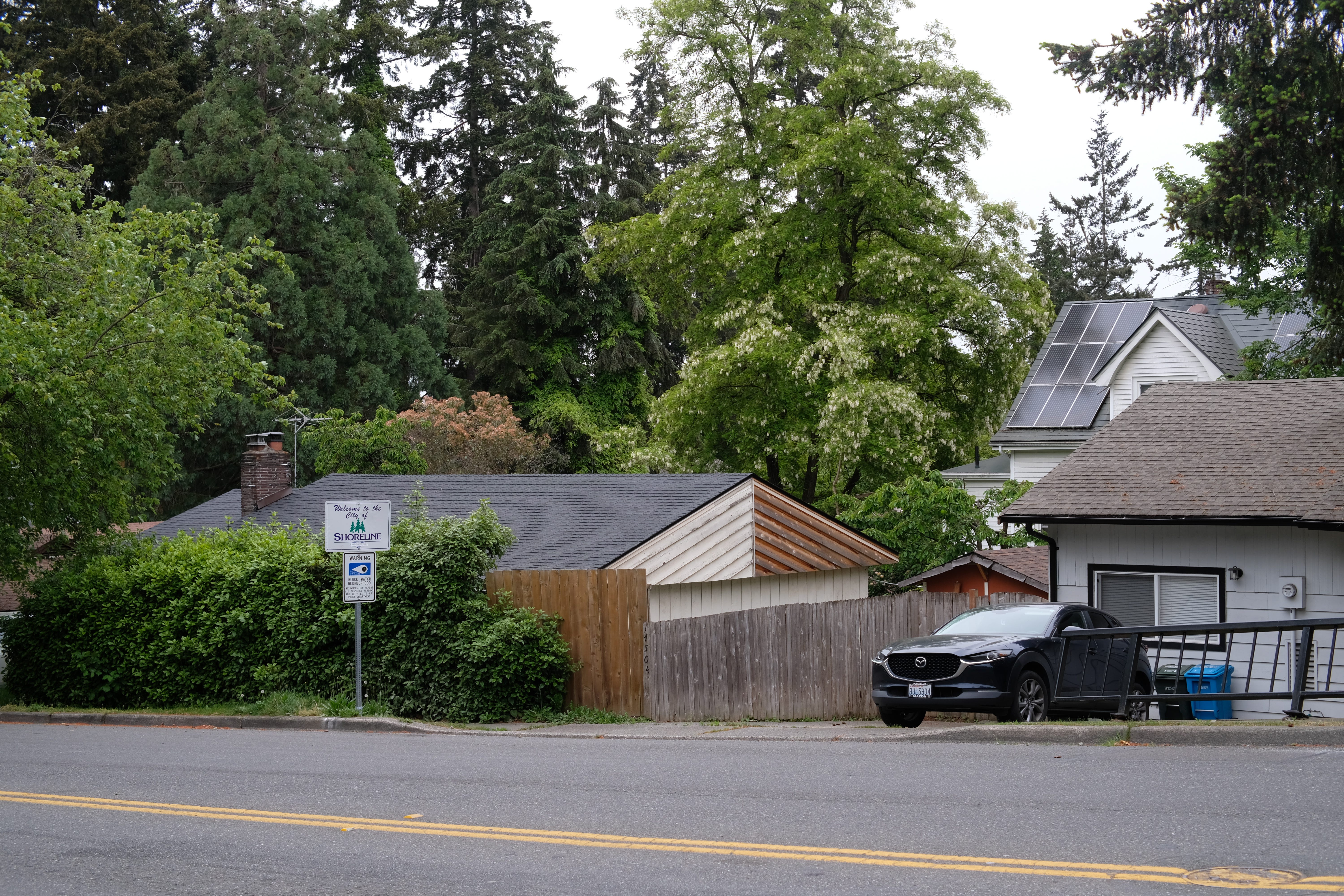
It is 11:21 AM. I’ve walked about eight of 31 miles, and I’ve just crossed from 205th Street North to 243rd Place Southwest, crossing from what was Shoreline in King County to what is now Edmonds in Snohomish County.
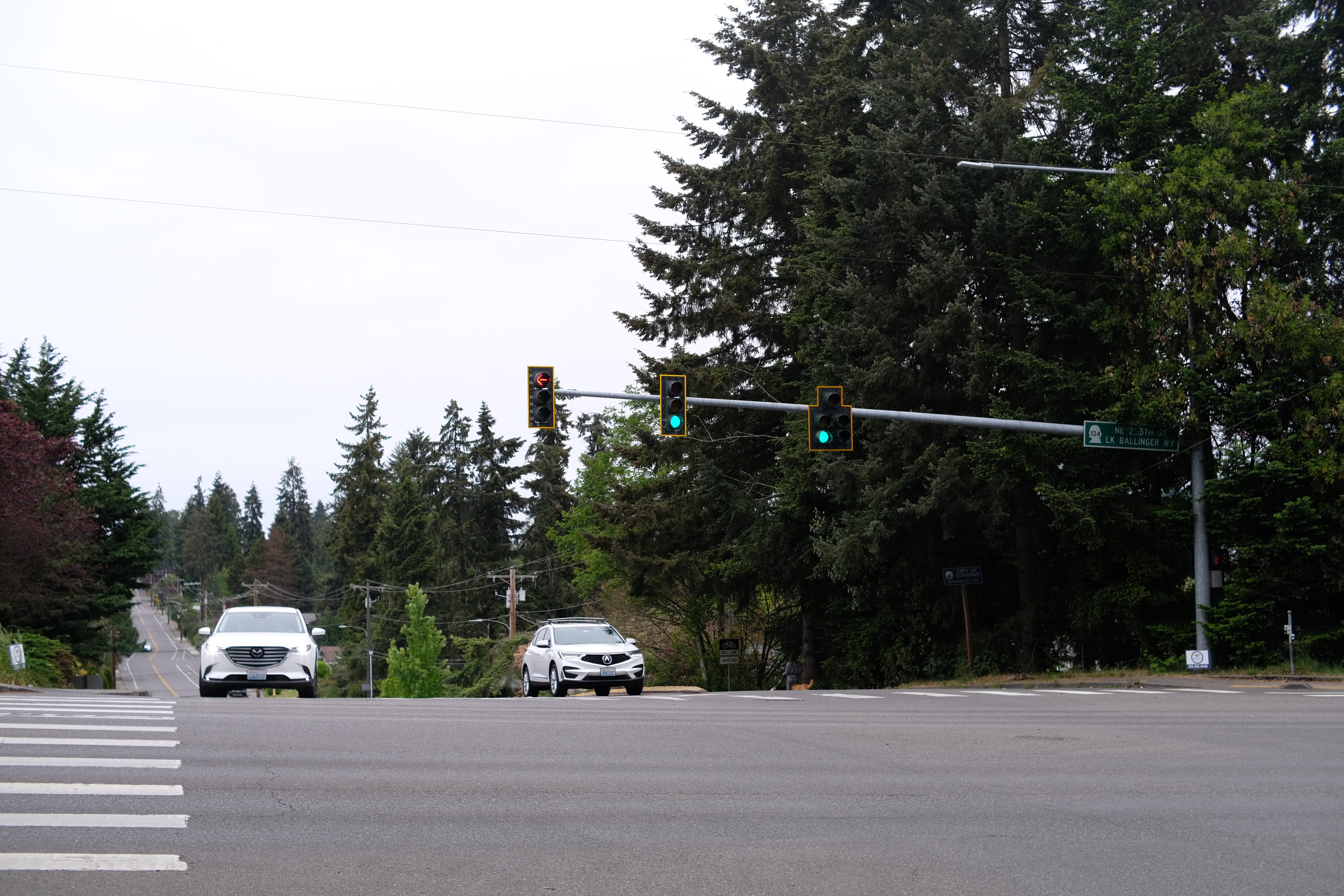
So far, the walk has been fine. There’s a little twinge in my right hip and left ankle, which were some of the usual suspects during the walk last weekend, so we’ll keep an eye on that. Other than that, I’ve done about half of the elevation gain and a third of the elevation loss—downhill is worse for everything than uphill, so that’s not great, but we’re going to get there, one step at a time.
I think we’re about a quarter of the walk done, so only three more of these to go. Let’s do it.
(still 11:21 AM)
A few things I forgot to mention:
How’s the weather? It’s been very gray and cloudy all day. Generally a good temperature, since I’m not getting too warm, but my core is a little warm and my fingers are a little cold. We’ll have to compromise there.
How’s the scenery? The scenery has looked basically the same the whole way. Seattle and [Western] Washington are generally very green, so it’s green trees on both sides of the sidewalk at all points, with some nice houses, but nothing to really be excited about. I’m not sure that there will be exciting scenery at any point during this walk, but suburbia is certainly not my top choice of “things to look at.”
What else? The most important thing is that in about 40 streets, we’ll be turning right onto Old Highway 99, where we’ll spend a lot of the rest of today.14 At that intersection, there’s an 85 °C, which has been one of my favorite bakery chains ever since I had it in China, and so that’s what I’m really looking forward to in the next hour or so.
Okay, those are the two [sic] important things I needed to add to this thick description that you’re getting. Now, see you later.
It is 2:16 PM. I’ve walked now 16 of 31 miles, so we’re about halfway through. I’m feeling all right, though I’ve still got some tightness in the right hip. I think we’re going to make it through today, and we’ll see what it feels like tomorrow.
I’m currently on SR-99, which is sort of just a trail of detritus between Everett and Lynwood, the latter of which I passed through in the past two hours. What has happened?
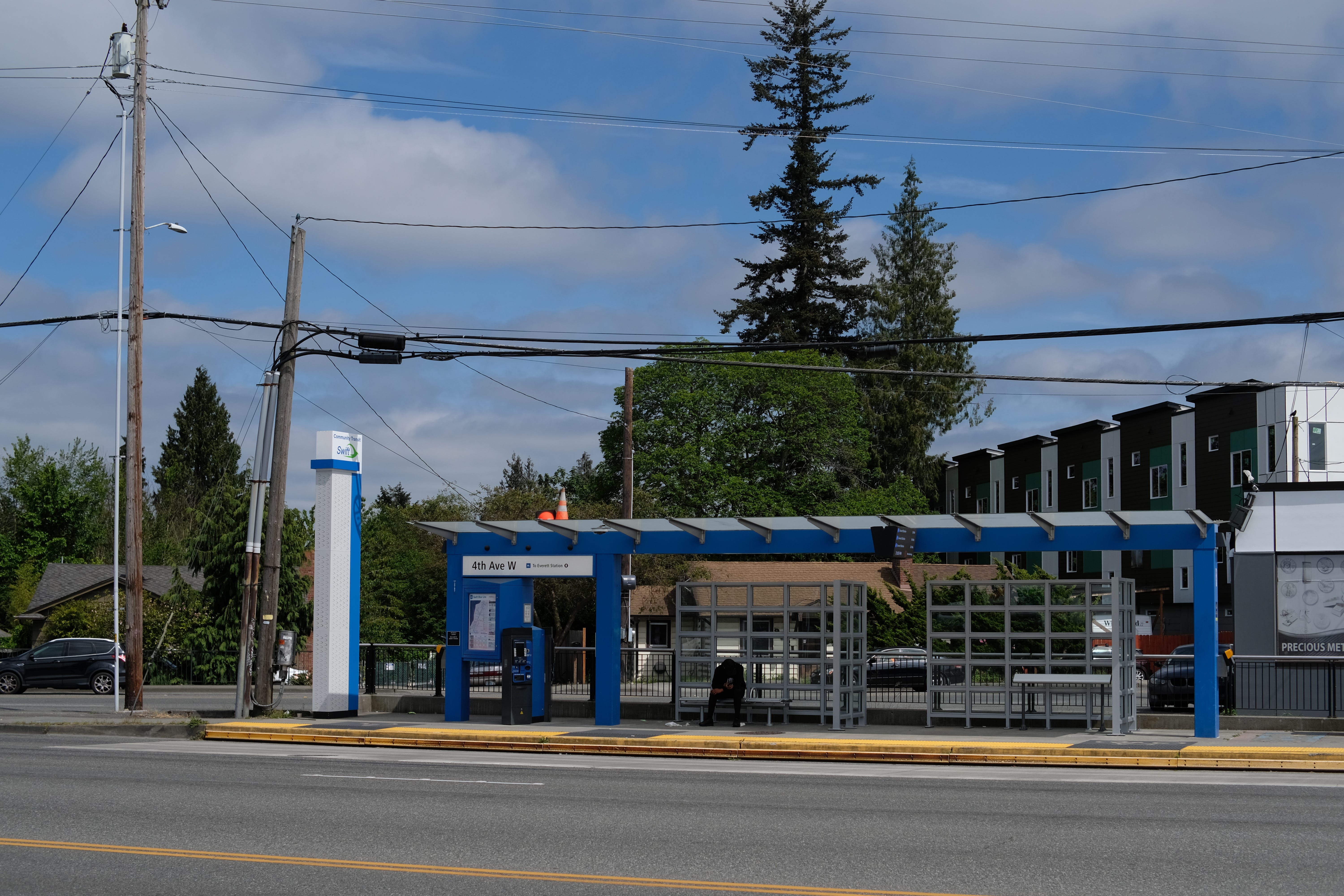
I stopped at 85 °C what feels like a lifetime ago, where I got a boba, some kind of berry custard, which I ate, and a brioche, which is still in my bag and I’ll eat at some point either today or tomorrow as a snack. I should, at some point, figure out what I’m going to eat in Everett, but I can do that at any point in the next two or three hours.
Halfway is pretty good! I wasn’t 100% sure that I’d make it this far today, so that’s exciting. It’s been interesting—it’s gotten two or three degrees warmer, which has been nice, and while we were in Lynwood, there were a lot of people around, which was also kind of cool.
One thing that makes walking exciting to me is that you get to slowly pass through a city, in a way that you otherwise wouldn’t ever do. When you’re driving, you don’t really pay attention to your surroundings; you’re really just focusing on what you’re trying to get to. But, here, since you move slow slowly, you kind of have to see what’s happening around you. For example, in Lynwood, there were a lot of people at a protest on the sidewalk,15 and I also walked past a couple of other people who were also walking, which is always cool.16
Other interesting things: I’ve done basically all the elevation gain for the day. I have probably half the elevation loss to go, which is a little annoying, but at least there’s no more gain. It’s all downhill from here.17 There were a lot of Asian grocery stores in Lynwood, and then a lot of car sales places. I’ve also seen three or four distinct “bikini coffee” drive-throughs, which has been super odd.
I’m reading Infinite Jest for the second time this year with a book club, and one of the things we talk about is how thickly Wallace describes things, and how it feels like you’re an eyeball standing really close to a moment or situation. Although I don’t have the ability to produce Wallaceian prose—especially not extemporaneously—walking does have a little bit of that roving eyeball effect, as I walk through and pay really close attention to what’s going on around me, since there’s nothing else to do. It’s just “brain off, listen to music, look at what’s around you.” That’s what I’ve been doing for the last two hours, and that’s what I’ll be doing for the next five or so until I get to the hotel.
I’ll probably be back around dinner. See you!
[note for audio listeners: the following clip contains a substantial portion where I am talking to a passerby. that conversation ends at 3:10.]
It is 3:32 PM. I’ve now walked something like 19 of 31 miles, so that’s pretty good. I’m still sitting at about a three-mile-an-hour pace, which is about where I want to be, especially today; hopefully, no faster and no slower.
I’m still on Highway 99. That hasn’t changed. I’ve now fully crested the hill and am descending into Everett. I think we’re in the Everett suburbs now, since there’s a lot more food around, and, oh my God, it is just—
Washington is so beautiful, in a way that it’s hard to capture if you’ve never been here—
[at this point, my recording was interrupted by a man sitting on a bench, who I had a brief conversation with]
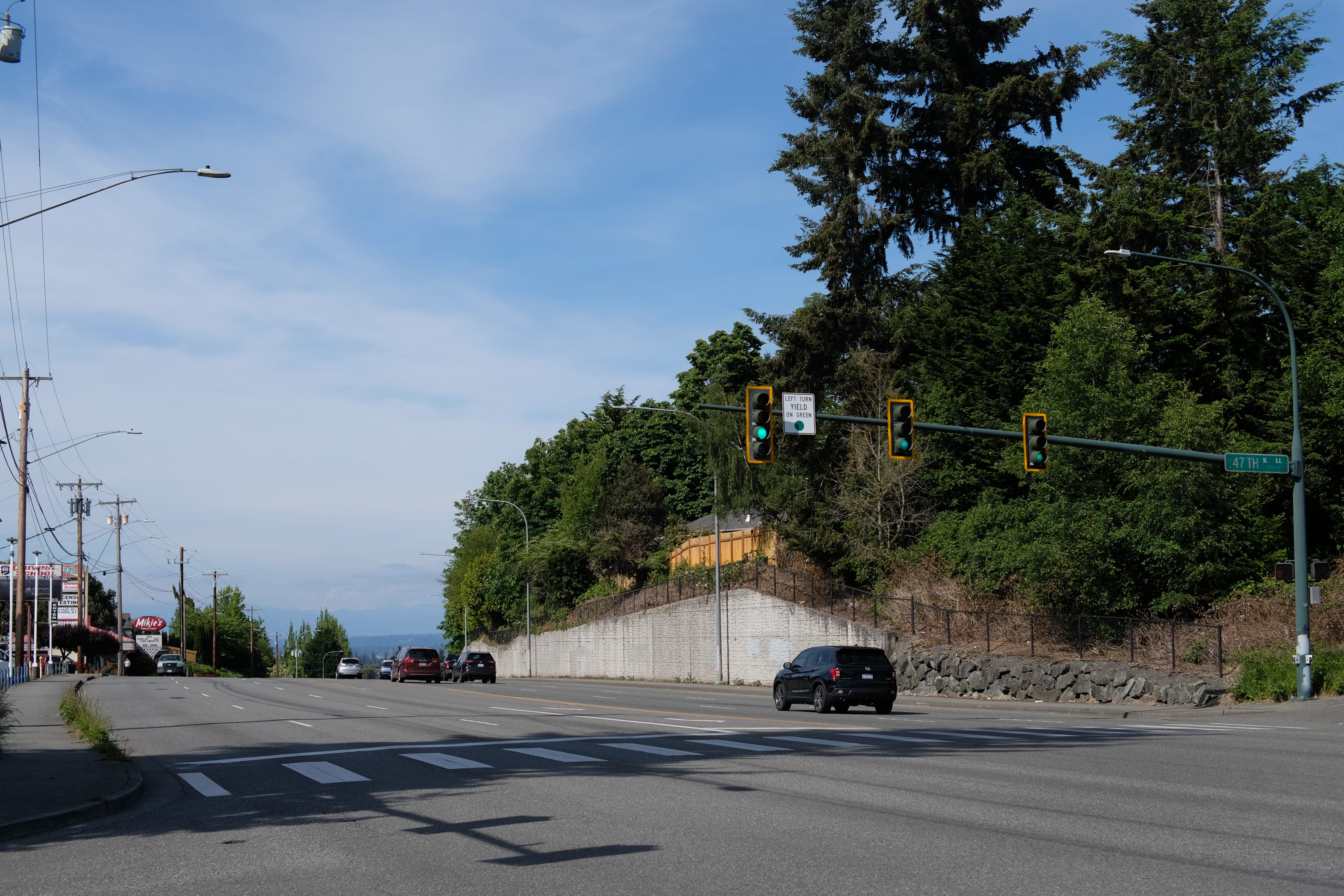
—I think the really crazy thing about Washington is how green it is. I grew up in a forest, and still, the first time I landed in Washington, I went “what is this place?” It looked like an alien planet. It is just so pretty.
The other thing is the mountains. Every direction you look, there are mountains. You’ll see these shadowy figures, and, at first, you think “that’s the edge of a cloud somewhere”, but it’s actually a mountain, everywhere you look. Right now, as I’m coming down towards Everett, towards the north, I can see the North Cascades in the distance, hinting at their presence. It’s quite something.
I really do love this place in certain ways. Seattle has not been my favorite place to live, for a number of reasons, but, well: you can say many things about it, but you can’t say that it’s not pretty.
In about four miles or so, I’m going to stop at a pizza place for dinner, hopefully around 5 PM. After that, I should have around eight miles left, which should be pretty smooth—three more hours to my hotel, and then I’ll go to bed, and then we’ll keep on going. See you after dinner.
It’s 5:59 PM. There are 7.5 miles left, so I’ve walked around 23 miles so far. 7.5 miles is, unfortunately, still over two hours, so it’ll be a little while until I can get into a hotel room, but I’m making good progress.
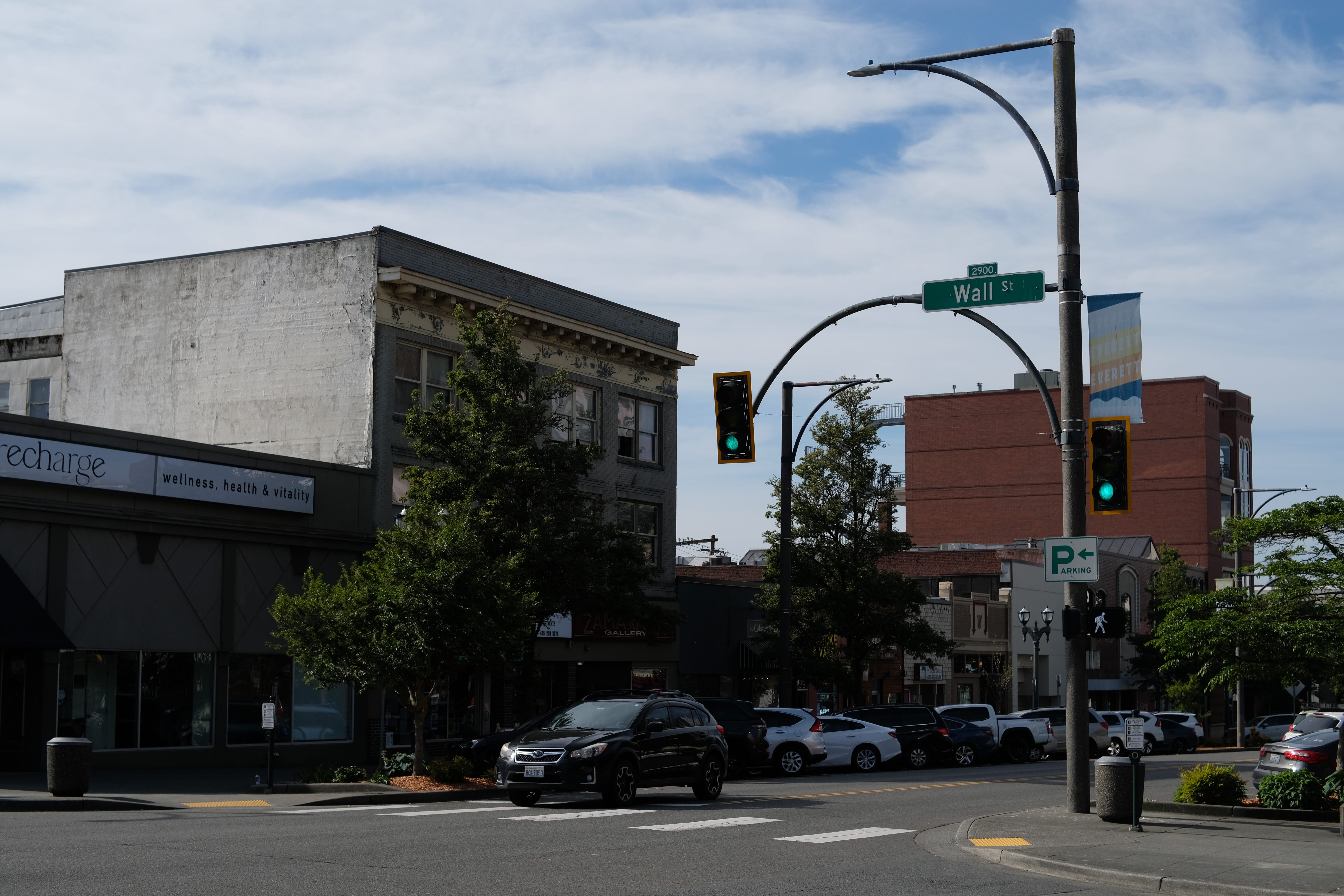
I had dinner at a pizza place, though not the one I originally intended to go to. I saw a lot of downtown Everett, which is really rather pretty; I have no idea why, but I assumed Everett was very industrial, and instead it was a nice, quaint downtown; the kind of downtown you see in a lot of places, where each has its own, small uniqueness. I apologize to Everett for my former misunderstandings of its nature.
I’m definitely, as the kids say, “feeling it, Mr. Krabs.” Maybe the kids do not actually say this these days—this is probably a meme of my generation. I’ve got a little bit of a stumble walk, especially post-dinner, because the legs are a little cold, but hopefully they’ll warm back up for the last little bit.
This last bit is actually the part I’m most nervous about today; I need to move a little more quickly, before the sun goes down. There’re some places here on a fairly popular road that have some pretty narrow shoulders, and I have to be careful. This is basically the last point in this journey where I’m going to be spending a substantial amount of time walking in town; there are other towns I’ll pass through, but this whole day has been sidewalks, and, from here on out, it’ll mostly be the side of the road, with only occasional sidewalks.
We’re crossing a bridge into Marysville very soon, which I hope will be pretty with the sunset. Day 1 is coming to an end; the next time you’ll hear from me is probably at the hotel, unless something goes horribly wrong. Let’s hope it doesn’t. I should knock on this wood or something.
[sound of knocking on tree trunk]
Other than that, the state of the walk is good. Is strong, I guess. Oh well, whatever.
Okay, I’m not quite to the hotel yet, but it’s 7:35 PM, and holy crap. That’s got to have been the most dangerous section of road I’ve ever walked. Oh my God.
Basically, the dangerous thing here is bridges. When you’re building a normal road, you can build the shoulders as wide as you want, and they’re usually fine. But, well, when you build a bridge, the wider the bridge is, the heavier it is, and so they really like to skimp on bridge construction.
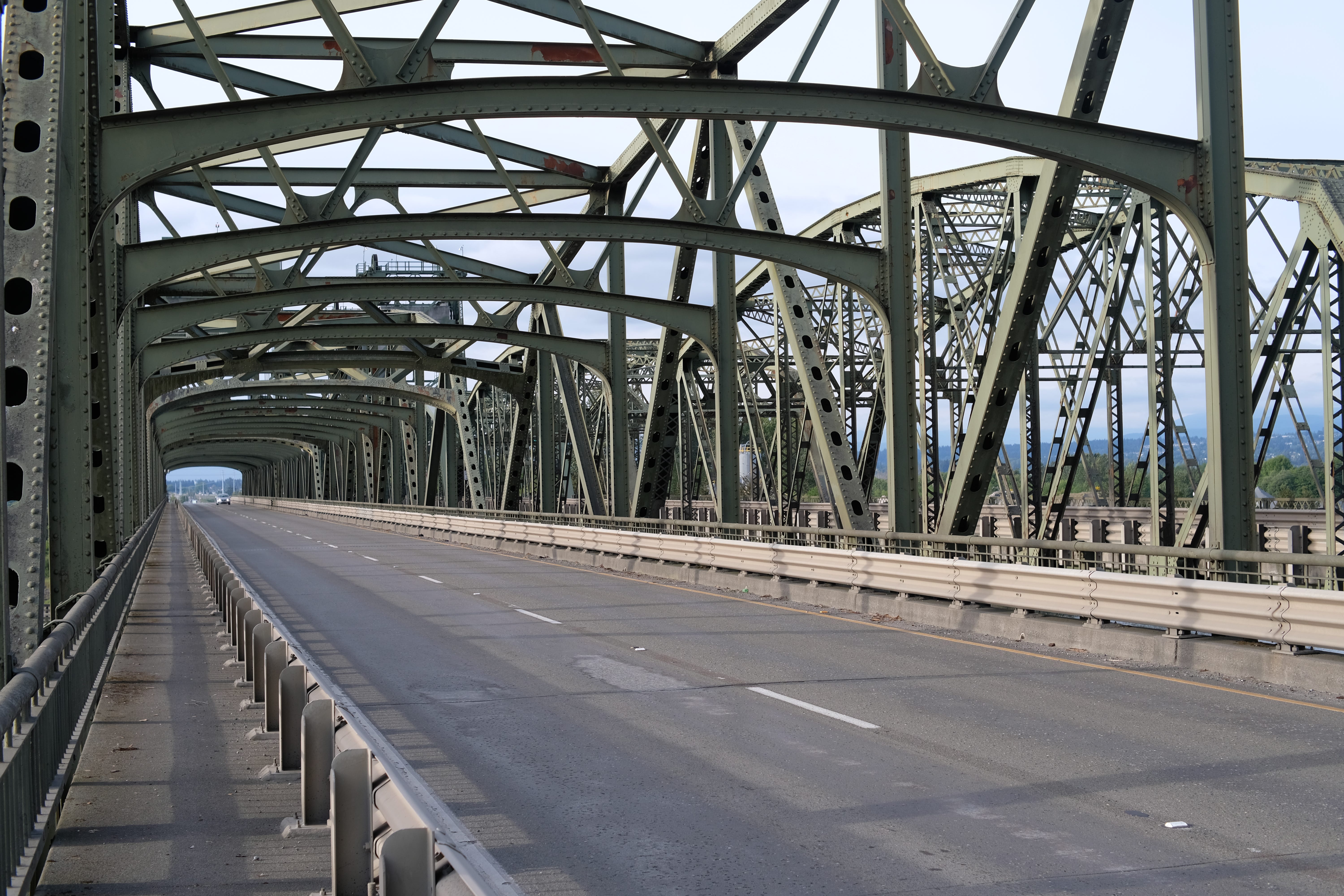
This particular section was a two-lane divided highway with a limit of at least 50,18 and I was walking down the shoulder of it. The bridges had some pedestrian walkways, but they were on opposite sides of the road from each other: the first bridge had the pedestrian walkway on the left, and then the second bridge had it on the right. I had to cross this two-lane highway, and then I crossed two bridges on the other side of the road (which is also not fun), and then I had to cross the road again to get off the highway.
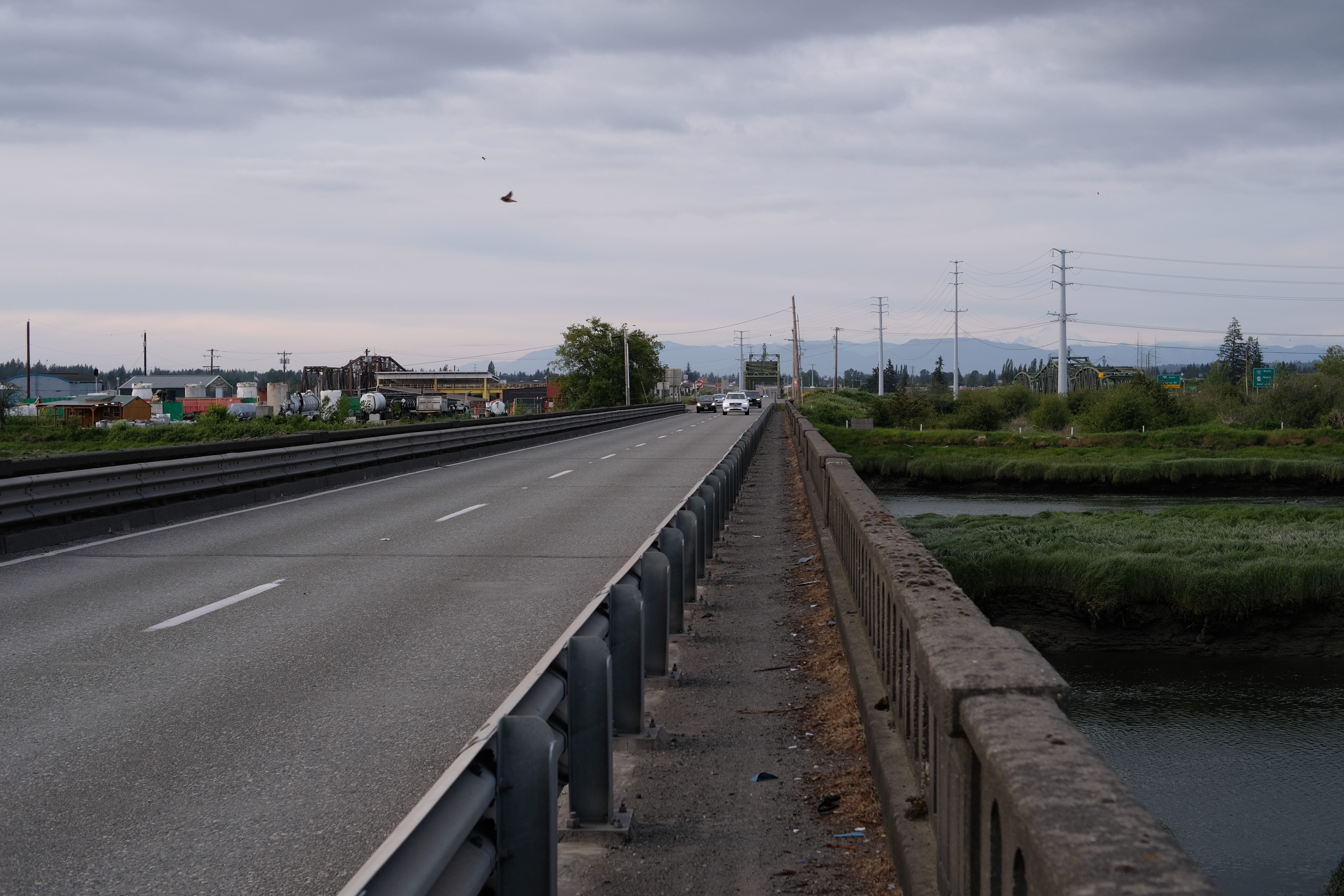
I’m now fully off the highway and on some local road in Marysville. I’ve got 2.7 miles left for the day, but, wow… don’t try that at home. That was ill-advised, and I’m glad I made it out of it. There’s going to be a lot more side-of-the-road walking in the next few days, but I don’t think any of it is going to be quite as bad in terms of high speed limits and narrow shoulders, or, at least, I hope not—I think I scouted everything.
Jesus. Anyways. Yeah. Knocking on wood was the right idea.
Now, we’ve made it. It’s real pretty. You can see a really snow-covered mountain; I think Shuksan and Evans19 are up here? I should learn which one is which, but, my God, it’s really pretty out here. There’s lots of water now too, with the sloughs, but yeah—would not try this again. Holy. See you in an hour.
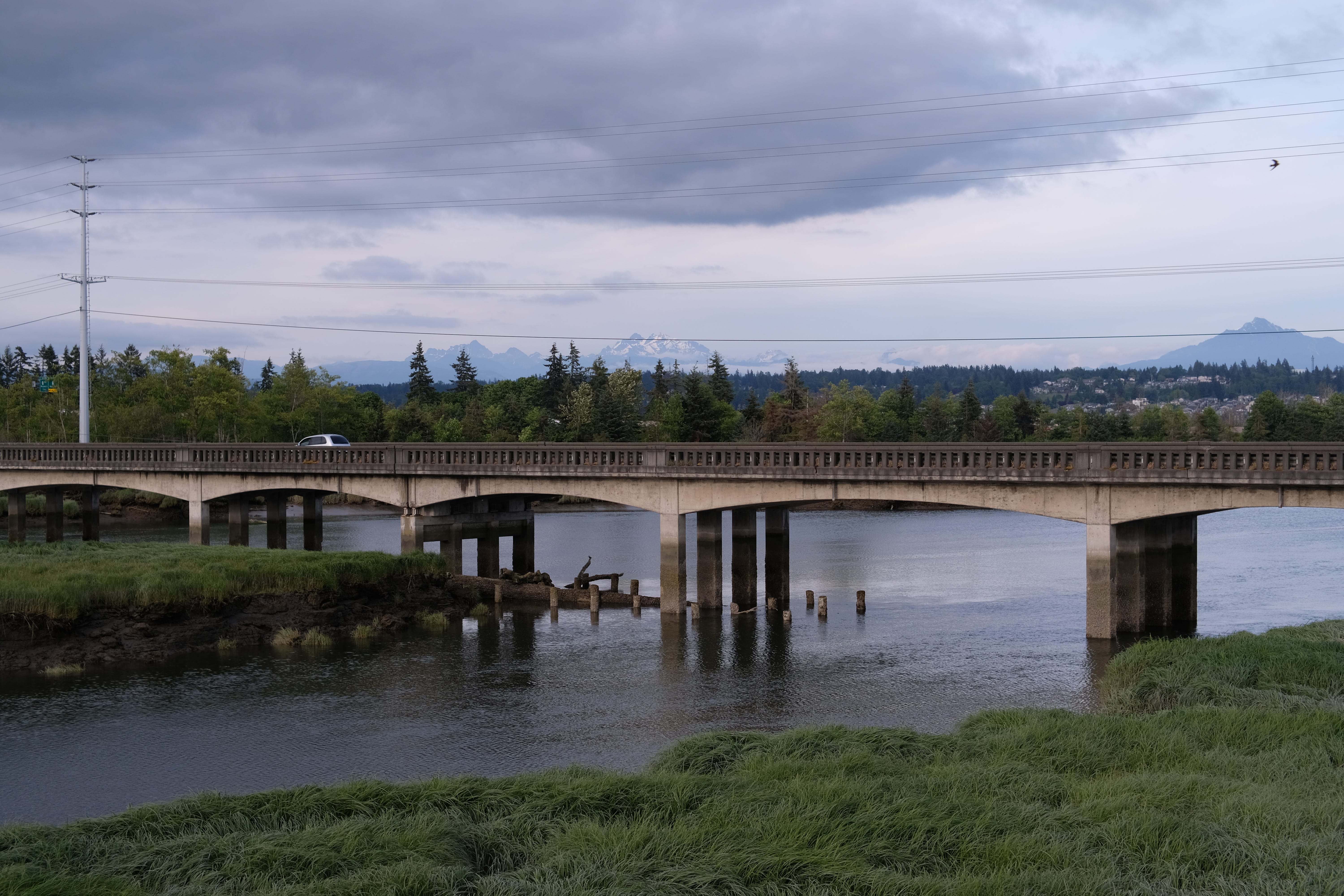
Hey, it’s exactly an hour. It is 8:36 PM. The brain cells are gone.
I’ve just checked into my hotel in Marysville; the last few miles were fine, and I took them really slow, which is good—got to save up a little bit of stamina for tomorrow.
I don’t have as good of a preview of tomorrow’s route as I did for today’s, since I don’t have my laptop with me, but I did scout the route beforehand. It’s the longest day of the walk—31 miles to Mount Vernon. Once I make it, the trip gets easier: I get two days of rest, and everything else is much shorter. The only good thing about tomorrow is that it’s the smallest elevation change for the entire trip with +500ft, -500ft. It’s very flat, but it’s a lot of distance, so we’ll see how long it takes. Tomorrow’s also the point of no return: so far, as I’ve walked, I’ve constantly seen buses that would take me back to Lynwood, where there’s a nice Link station that could take me straight home, but, presumably, that ends tomorrow.
Mostly, everything feels fine. Usually, the thing that hurts most is the pads of my feet, and they’re mostly fine today. I’ve got some weirdness throughout the legs, which is never great, but we’ll see how that turns out in the morning.
Tomorrow’s a little odd, because there’s no place to eat after lunch until we get to the final destination. There’s a place around mile 10, called Willow and Jim’s Country Cafe, which hopefully will be open on the Sunday before Memorial Day. If it’s open, that’s where we’ll eat, and we better eat good, because we’re not going to eat for another 21 miles.
Basically, there’s a lot of things stacked up against tomorrow, which is not a great way to think about it right before you’re going to do it. The positive way to think about it is: if we make it through tomorrow, the rest of the trip will be somewhat easier, or, at least, there will be less risk to it.
That’s all for today. Hotel check-in was really smooth; I’m hoping that’s going to stay the case. I’m probably going to shower, spend some time on a call with some friends, eat some bread and drink some water, and call it a day. Early night, hopefully early breakfast and early leaving tomorrow, so we get a good headstart on the 31-mile day.
Good night. Thanks for listening.
day 2: to mount vernon, wa (31.4 mi)
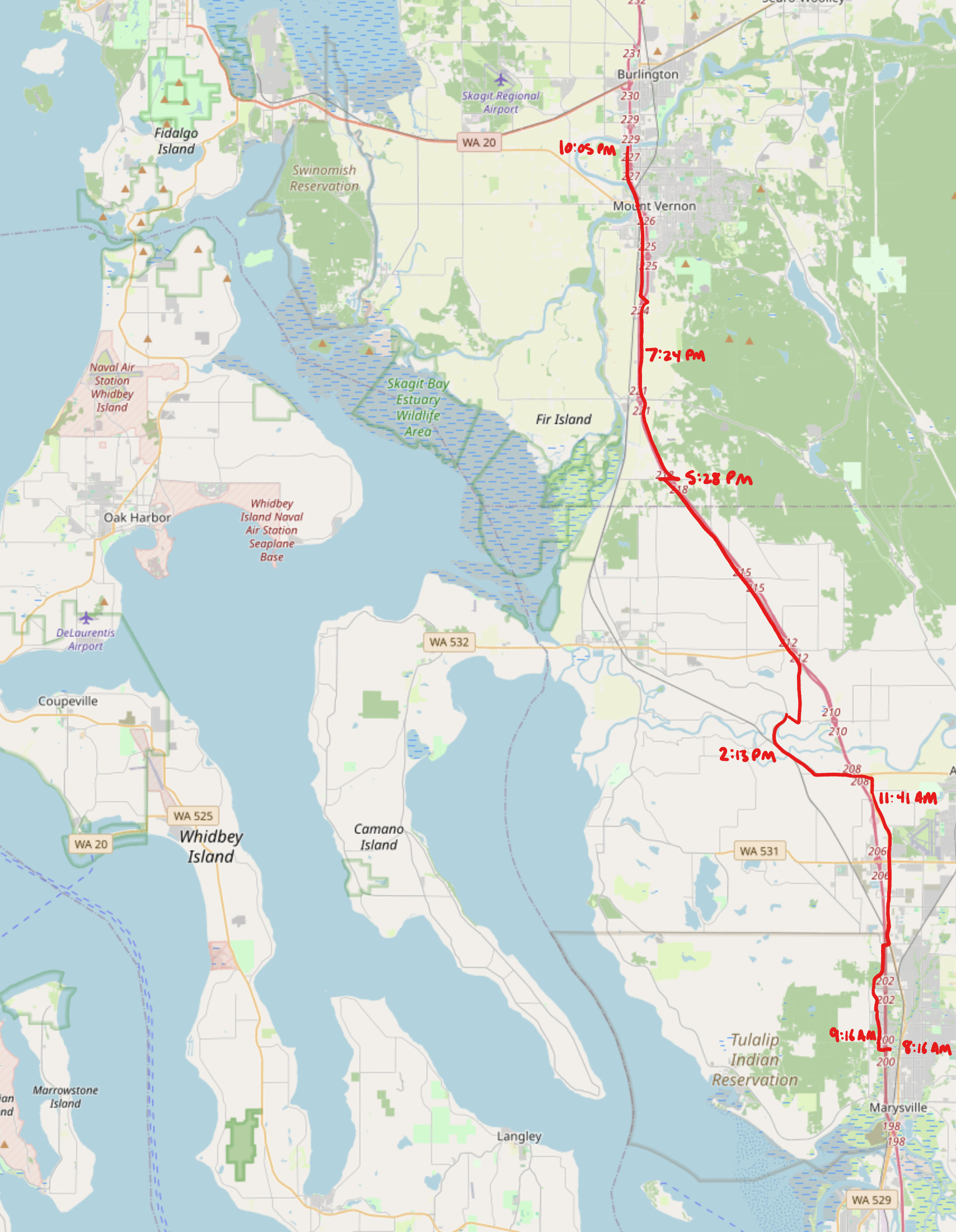
It is 8:16 AM on Sunday, May 24th. Day two of the walk begins today.
I just woke up. Status-wise, everything feels mostly okay. I did wake up quite a bit in the middle of the night, weirdly. Towards the end, I had 30-minute REM cycles, which was super odd: just fall asleep, have a dream immediately, wake up thirty minutes later. I was also very thirsty in the middle of the night, and I walked down to the lobby with my water bottle and no wallet, where I saw the vending area and I went “oh, I should buy a Gatorade.” So, I walked back, and then walked back down to the lobby with my wallet but no water bottle, and as I returned with the Gatorade, I realized there was also a water bottle filler in the lobby. But, well, that’s what waking up in the middle of the night gets you.
Mostly, the legs feel okay. They’re a little sleepy, I guess, and we’ll see what it’s like after a few minutes on the road. For now, I’m going to get changed and eat some hotel breakfast, and I’ll see you after I get on the road and see how it all feels.
It’s going to be an interesting day. I need to remember that I can bail at any point, but we’ll see how it goes.
It is 9:16 AM. I left the hotel around 8:50 AM, so I’ve walked for about 20 minutes, and I’ve walked about a mile, so that’s about right. I had a very typical hotel breakfast, which was Fruit Loops and milk; that should hopefully tide me over to the food at the 10-mile stop.
It’s a little chilly outside, but I’ve been going without my sweater, because it’s quite a hassle to get it out of the bag and then put it back in the bag later. My legs are way stiffer than I would prefer. During the training walks, they got super stiff at night, and, by the morning, they had gotten a lot better. This was sort of the inverse of that: when I got to the hotel last night, I felt mostly fine, and now I’m way stiffer than I was. Hopefully, that will work off a little bit as I warm up, but if not, we will have to reconsider some of our life choices, because I don’t think it is feasible to walk 31 miles this way.
We’ll see. That’s the reality, but we’re going to keep walking until we decide that it’s actually time to give up, and that probably won’t be for another nine or so mile. Anyways, I’m passing through the parking lot of a resort casino, so I’m going to shut up. See you all soon.
It is 11:41 AM. I am still walking. I’m still kind of hobbling, but I’ve been able to keep up both cadence and pace, which is what I was really worried about.20 My Google Maps ETA has not wavered thus far, and my steps per minute has stayed at a reasonably high rate, especially when listening to music, so I’m going to keep going for now. I’m going to make it to at least lunch, and then—
You know, I’ll probably keep going. Who am I? You’re going to learn from this audio recording, if you didn’t already know me, that the stubbornness is a negative attribute and not a positive one.
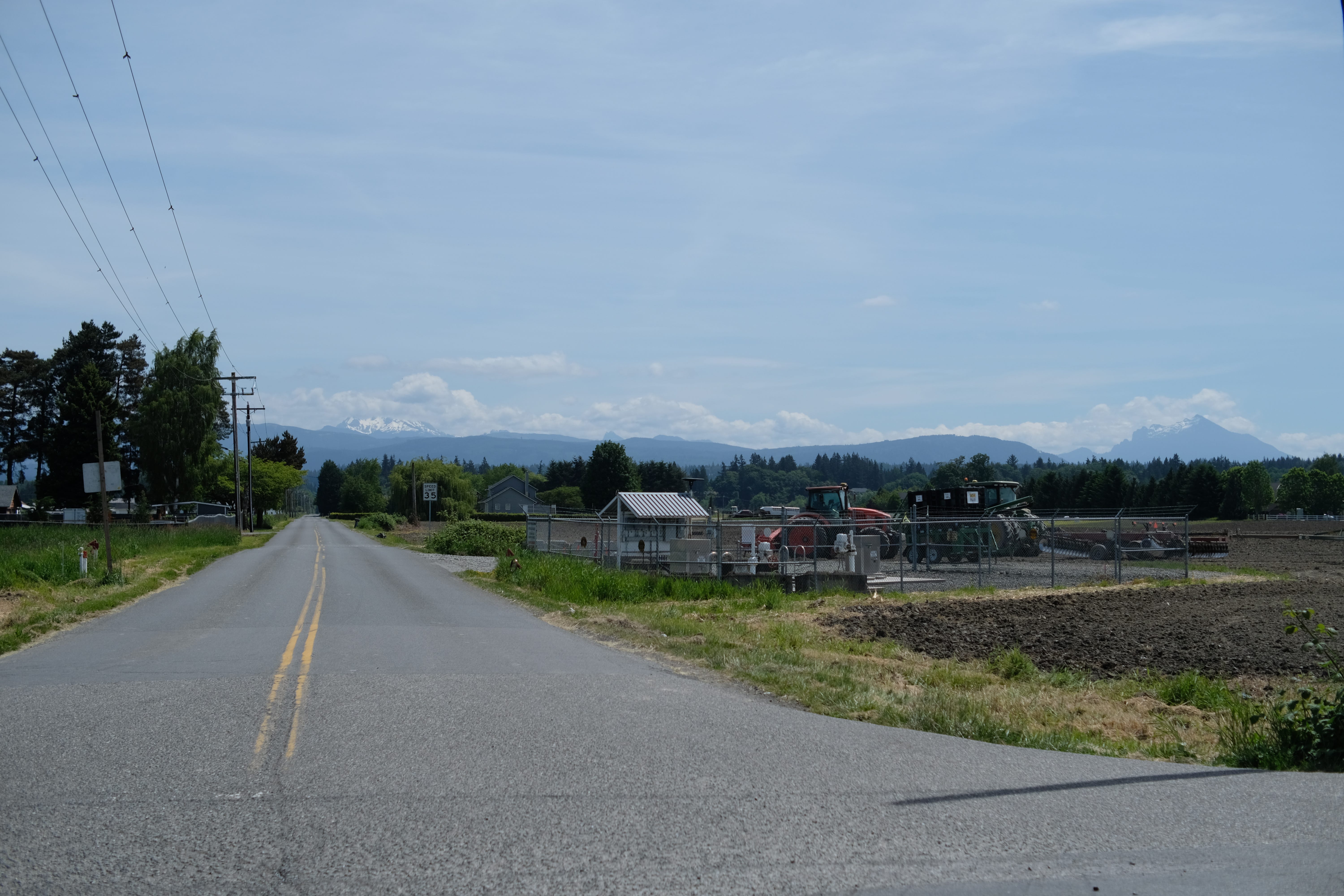
It’s quite warm now—it’s warmed up over the day. The sun came out. I remembered that when I was applying sunscreen this morning, I applied it everywhere except for my face, which is a good thing to remember; I put it on while I was walking. I had a good sidewalk section on Smokey Point Boulevard, which brought us into Arlington, but now we’re back to the side of the road and nothing.
I’m nearing 200th St NE. I started today at 88th St NE. I have no idea where the northernmost street I’m going get to today is; I do know I’m going to be in a different county by the end of the day, so the street grid will reset.
I’m slowly stumbling forward. The current Google Maps ETA for when I get to the hotel is 8:14 PM. I’m going to eat lunch, so that’s probably going to add 45 minutes, which means something like a 9 PM arrival in Mount Vernon. That’s not bad—I expect I’ll probably end up losing about half an hour of time at some point in here as well, but as long as I don’t lose more than an hour, I think I’ll be okay.21 I also apparently got a sunburn on the back of my neck yesterday; it wasn’t sunny for most of the day, so I forgot to put on sunscreen when the sun finally came out. I’ll sunscreen at the beginning of the day from now on, but, uh, well, happens.
The causes for concern are my left knee and right hip—it was my left ankle yesterday, but the ankle actually seems fine now. Hopefully things will be alright; I’ll get two days of rest after this to heal up and do the last 75 miles, so we’ll see.
I’m going to get back to focusing on not getting hit by cars, so, see you in a bit; likely, after lunch, which should be about an hour from now. I haven’t checked, since I told myself I wouldn’t look at my phone while I was listening to the soundtrack of the movie Mamma Mia (2008), which is what I’ve been doing for the past hour. This is in honor of Mamma Mia May, where my friends and I experience Mamma Mia (2008) over and over, like the Entertainment in Infinite Jest.
Okay, that’s enough babbling. See ya.
It is 2:13 PM. We are 11 miles in, out of the 31 miles today, which is not as far as I would really like to be—or, more accurately, I would like to have gotten here earlier, but such is life. I had lunch at Willow & Jim’s Country Cafe, which was one of those classic small-town diner places that I miss sometimes, so, nice to have. Now, we’re back on this highway.
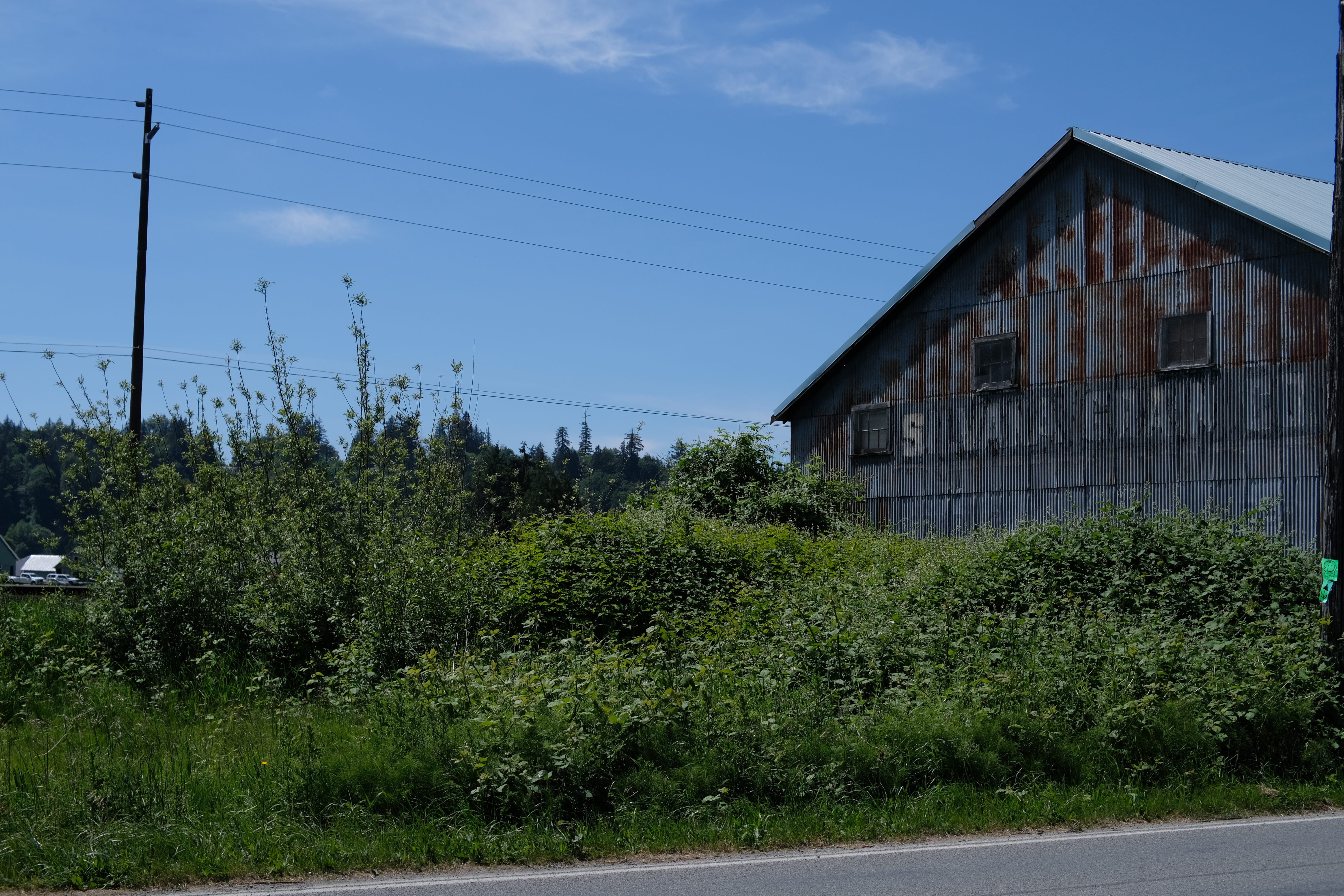
We’ve lost a lot of time on this highway; there’s been a lot of waiting for cars, since the shoulders are pretty small. I’m hoping to keep pace, especially once I get off the highway in a couple of miles; it’s not looking so hot for making it to the end of this, but I’m hoping to make it to SR-99, which is the big road. I’ll be on that road for six miles, and, if at some point during that six miles I give up, then I give up.
Twenty miles left to go. Hopefully, we’ll make it to half, and, if we make it to half, then, I’ll be happy or something.
That’s not true. I’ll never be happy, but if we make it to half, it will be slightly less embarrassing. I don’t know; I knew day two would be hard, and it definitely is hard.
There’s no stops from here to the hotel; the food spots are all in Mount Vernon, and the hotel closes check-in at 11 PM, so I just need to beeline straight to the place. The ETA right now is 9:19 PM, according to Google Maps. I can lose an hour and forty minutes. I don’t expect to lose an hour and forty minutes; I expect to lose some time, but here’s hoping it’s not too bad. We’ll see.
There’s a sign here to Warm Beach, and I’m in the middle of the countryside. I guess it must be a lakeside beach.22
Anyways. The walking continues. See you in a bit.
It is 5:28 PM. I’ve got 11 miles to go, which means I’ve walked 20 miles today. I’ve actually kept pace with Google Maps somehow—ETA of arrival is 9:21 PM, just two minutes later than the ETA when I left the restaurant, so that’s good.
I just listened to the entire cast recording of Hadestown, which turns out to be super good walking music, since it’s about walking, among many other things. I went up a couple of different roads, but I’ve been on State Highway 99 or Old State Route 9923 again for the last six miles; I’ll be getting off very soon to go to the other side of I-5, where there’s basically an equivalent road.
I should probably take a break at some point in the afternoon and not walk seven hours consecutively—that seems non-optimal—so I’ll probably find a spot at some point to sit and drink some water. Maybe at a gas station? I’ll probably make to the end of the day, which I definitely wasn’t feeling at the beginning of the day, so I’ll count that as a win.
I’m now in Skagit County, which I think is the northernmost county in Washington; I guess I’ll have to check that later.24 After many hours, I am no longer in Snohomish County, where I started at 242nd Street SW yesterday (after crossing from 205th St N in King County). Now, I’ve crossed out of Snohomish at 332nd North. There were a lot roads in Snohomish, and now it’s time to cross Skagit, where I’m starting at 200-something South. Man, these grid systems just keep going.
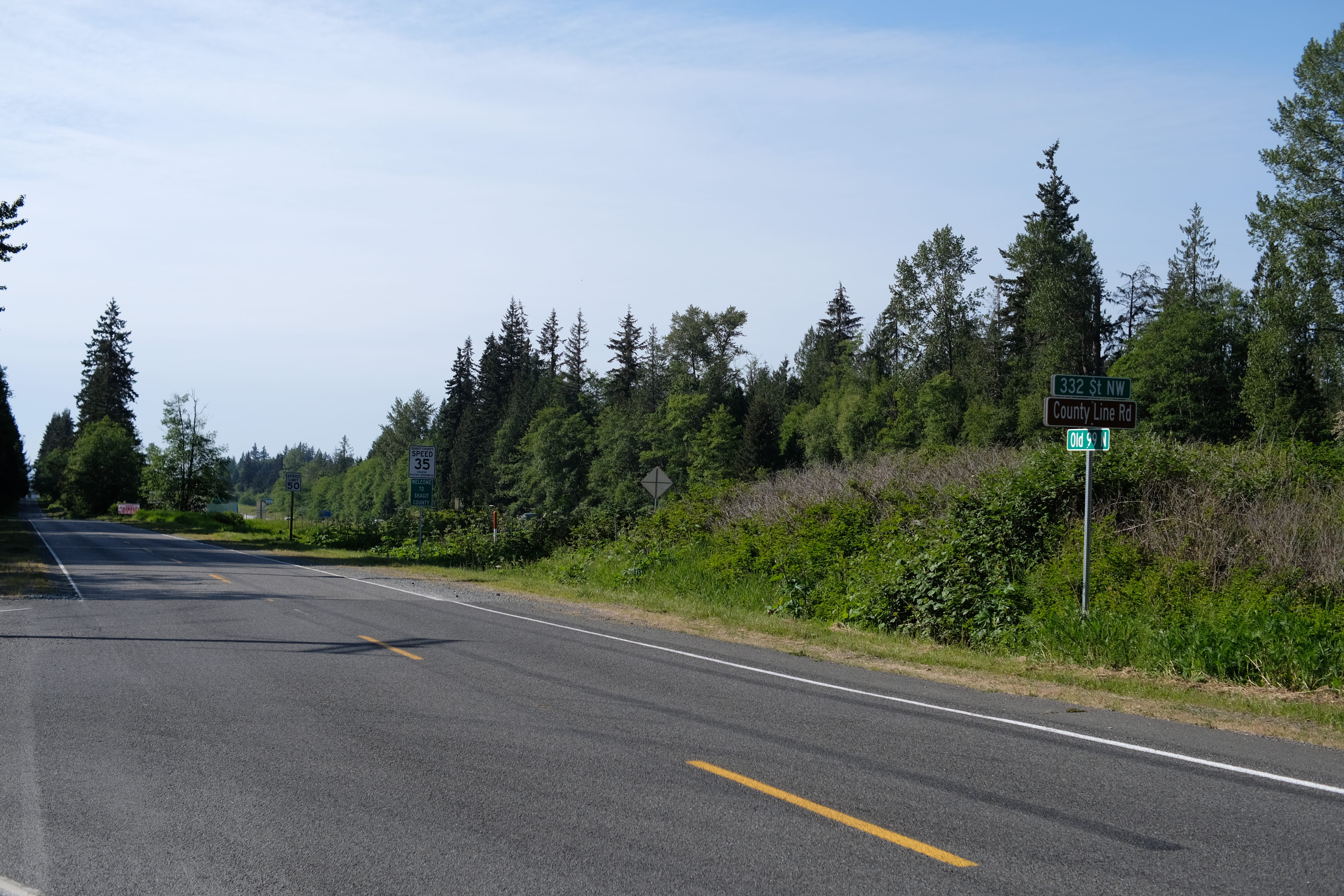
I’m not feeling super great. I’m walking at a very consistent pace, but it’s not a fun pace; I’m kind of waddling quickly. There’s really nothing interesting happening. It was really warm for a while, but there was shade in a couple of spots, so I’ve just been going back and forth from “very warm” to “oh, thank God, there’s shade” for the past few hours, and that’s about it. It’s just backcountry. I might be able to see the mountains again after I make this crossing, though, with the exhaustion, I don’t think I’m going to be able to really appreciate the view of the mountains for the next 11 miles.
I don’t know when I’ll next record something, but I’ll probably do it at least once before I get there. We’ll see when it hits. Cheers!
It is 7:24 PM. I’ve got six miles left, which means I’ve walked around 25 miles. This is also like the longest distance I’ll have to walk for the rest of the trip, so there’s that.
One of the odd things about walking long distances like this is that you go, “oh, yeah, there’s only six miles left; that must be a small number, compared to the 20s and 30s that I’ve been looking at, right?” Then, you realize that that’s actually two hours of walking. In fact, there are still two hours of walking remaining in my journey, which is terrifying, because, yeah, it’s a small number, but that’s still quite a bit of time.
I’ve been walking through this valley for a while now, near I-5. I’m basically on a frontage road; SR-99 [sic] was also that, but I’m now on the other side of I-5, for whatever reason. ETA is 9:37 PM, which is a little later than before; I did stop off and get a root beer at some point, but that can’t account for 17 minutes of delay.
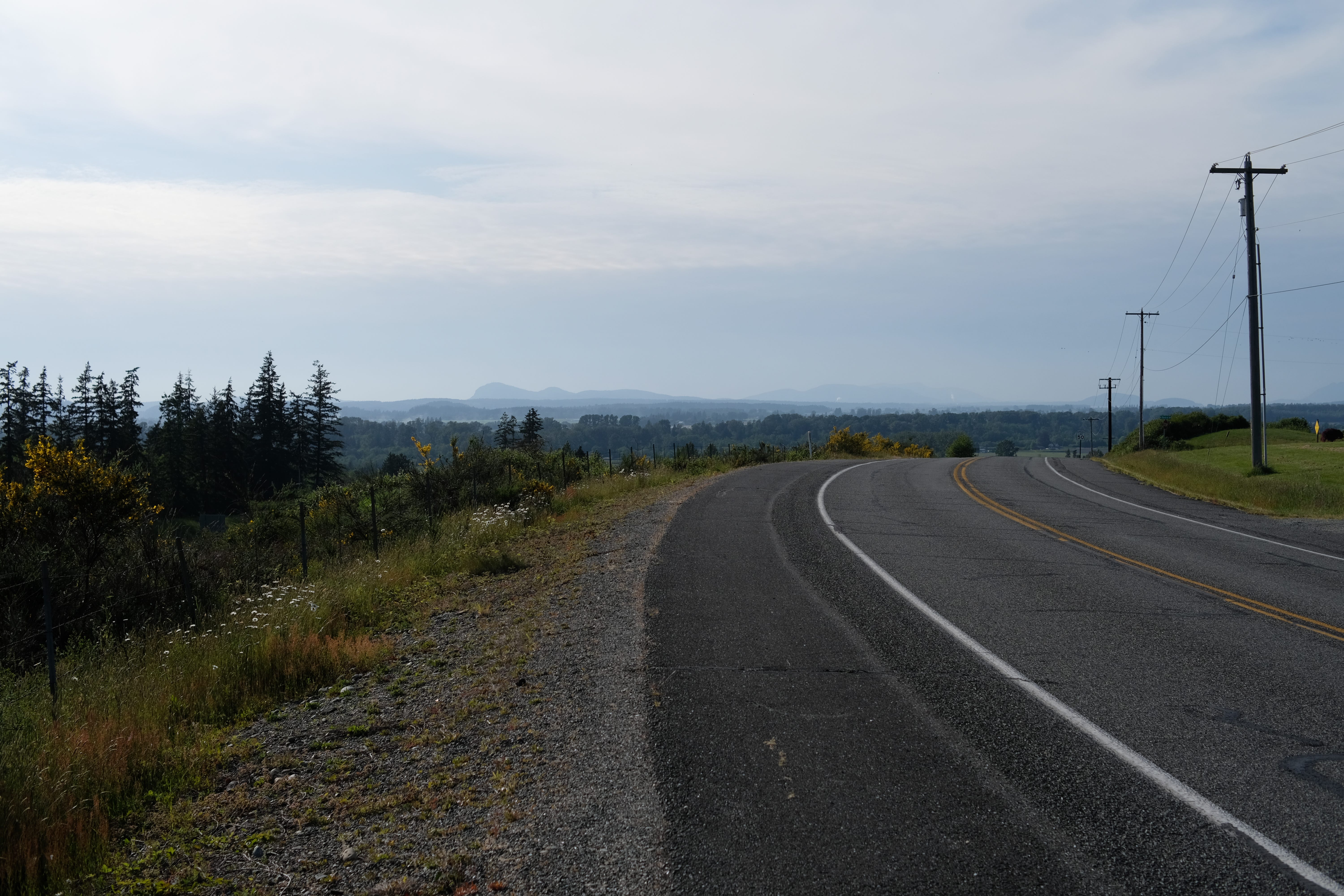
Whatever mountains I identified yesterday were completely wrong, because now I see the one that I think is Shuksan,25 or, at least, the ones in the North Cascades. It is really pretty down here; green fields, the yellow flowers that live here26, and then pine mountains in the distance, below the distant, snow-capped peaks of the North Cascades. It’s also nice because it’s started to cool down now, with the sun behind the clouds; hopefully, I’ll get into town before it gets fully dark.
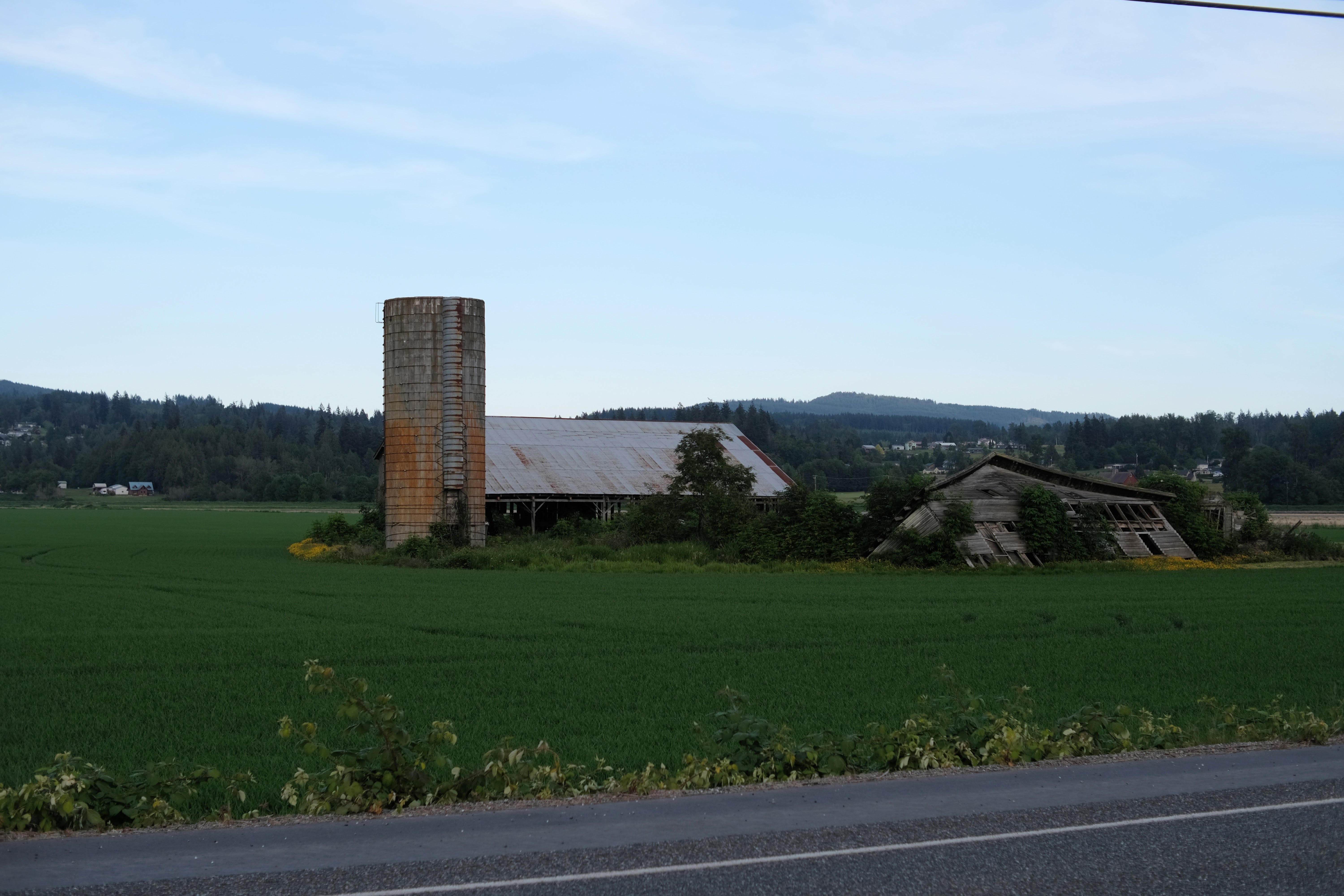
But, yeah. I’m going to make it! It’s probably going to cost me some amount of spiritual and physical damage, but I’m going to make it, and then we’re going to see what the next few days are like in the recovery phase. Fortunately, I don’t have to walk any longer than 25 miles from here on out, but that’s still 25 miles, so, we’ll see.
Be back in hopefully two hours.
It is 10:05 PM. I have made it.
The last three miles were probably the second-hardest three miles I’ve ever had to walk,27 but we made it. We pushed through one step at a time. That may or may not have been a good decision, but we did it.
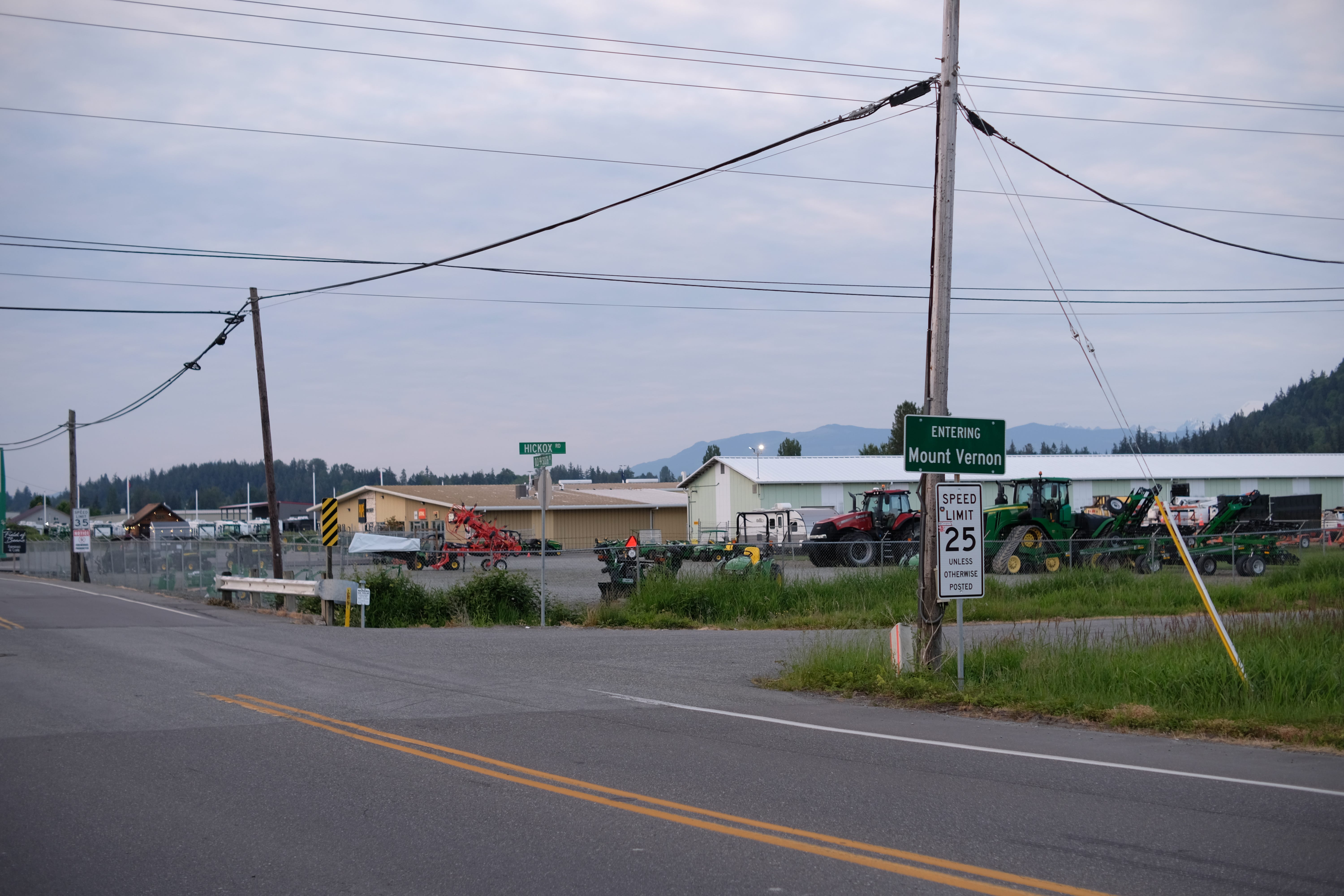
Nothing much happened in the last few hours. Mount Vernon seemed like a pretty cool town, but I did not see any of it because I was just locked in, walking, trying to fight off the pain until I made it here. Fortunately, I’ve got two days of rest here—three nights—which will be nice, and, after that, it’s all downhill from here; that is, it’s all shorter than this.
We’ll see how all of my appendages feel when I wake up in the morning. Towards the end, I felt a general “everything in my body is tired”; I’m not sure if that’s better than the specific “right hip and left knee” pain I had at the beginning of today’s walk. We’ll have to see.
Tomorrow, I’ll have to forage for food. There’s some fast food places around here and a WalMart, so we’ll see what happens. Other than that, I’m just going to be reading Infinite Jest to catch up for book club tomorrow, and then sitting around, letting time pass.
What have we learned today? We’ve learned that even if you are in pain, you can just keep going one step at a time, for miles on end, and maybe that is not actually a good thing, but that is a thing we continue to learn every time we do something like this.
No thoughts, head empty. I’ve been walking for, what, 11 hours today? So, I’ll be to bed soon.
ed. note: you are.
ed. note: the daily journal is a private blog that I have posted to daily for 2800+ days, as previously documented here, among other places.
notably, not Vancouver, Washington, which is further away, and, for the non-Washingtonians, is, in fact, a city that exists.
ed. note: maps in this post are screenshotted from OpenStreetMap.
ed. note: in fact, seven days later, the border agent asked me this exact question, and I found it similarly hard to answer.
ed. note: substantial textual omission here due to some misspeaking, and then subsequent crashing out about that misspeaking, incl. “Oh God, this is gonna be awful to edit. I’m not gonna edit this. You’re just gonna have to deal with my inability to speak properly.”
ed. note: I ended up bringing the 35mm manual focus prime.
ed. note: substantial textual omission about whether this was day “negative one” or “zero”, which was uninteresting and ended in zero-indexing bashing, which I now regret. zero-indexing is great; I apologize to zero-indexing.
ed. note: this is incorrect.
ed. note: this is also not entirely correct, and is corrected in a later recording.
ed. note: I have since learned that there is a small issue with this math. In Seattle, north of the ship canal, streets are spaced such that there are 20 per mile. However, in Snohomish County (and some other parts of King County), streets are spaced such that there are 16 per mile. Hence, the streets in Snohomish County are further apart than the ones I was crossing in Seattle. Alas, unit conversion gets us all.
ed. note: most importantly, including at MIT, which is kind of mind-boggling.
ed. note: one somewhat interesting insight I had later is that, in terms of physical exercise quantity, walking to Vancouver is more like race-to-idle, in the sense that I don’t have a high base rate of exercise, but instead spikes where I do a lot more in a short burst. I still don’t know what to do with that insight.
ed. note: I think this was actually twenty streets. Also, I would, in fact, be spending a lot of time on Old Highway 99 throughout the entire rest of the walk, not just this day.
ed. note: I think the important thing about this protest, which I neglect in the recording, is actually that people were very nice and it was cool to get to smile at people as you sort of go on your own journey. At one point, I was even offered (but did not take) cookies.
this is something I really enjoy about hiking, actually—the customary sort of nodding and saying ‘hello’ and whatnot to other people on the trail, which gets sort of ingrained in you if you go hiking as a child.
this is one of my favorite English phrases, because it can either mean something really good or something really bad, e.g., life is “all downhill from here” (i.e., it only gets worse), or you’re on a bike and the road is “all downhill from here” (i.e., we can cruise for the rest of this). In this case, it doesn’t mean really either of those things, but it’s something I think about when I use that phrase.
ed. note: I have since confirmed the limit is, in fact, 55mph.
ed. note: Mt. Shuksan is substantially further north. Mt. Evans is in Colorado. This was likely Three Fingers. The mountain I was likely trying to refer to was probably Baker.
cadence being number of steps per minute, and pace being actual distance traveled per minute (ed. note: usually measured in minutes per mile).
ed. note: we end up losing about an hour, I think.
ed. note: Warm Beach is, in fact, on the Puget Sound. Although this was, in fact, one of the most inland parts of my path, it turns out it was still only around seven miles from the coast. Go figure.
ed. note: both of these statements are incorrect. This is old US Highway 99, or the Pacific Highway.
ed. note: it is not.
ed. note: this identification seems correct to me, this time.
I should know what these are. Being able to identify flowers and birds is like a prerequisite for being a poet.
the award for the hardest three miles goes to the end of the 63-mile walk from Maine.
need to remember that I can bail at any point » i remember we talked about this a lot toward the tail end of the subway challenge, and we never redeemed it